Commissaires : Philippe Terrier Hermann, Alice Schÿler Mallet, Sarah Michel
La cartographie : une histoire locale
Au 16ème siècle, en pleine renaissance,
dieppe est en effervescence : le port
développe de nombreuses relations
commerciales avec les autres continents
et l’armateur jehan ango, gouverneur
de la ville, affrète plusieurs expéditions
de découverte vers les amériques.
cette importante activité maritime
s’accompagne de l’implantation dans
la ville d’une école de cartographie
qui produira des mappemondes
et des portulans (cartes nautiques
indiquant les ports) de grande valeur,
à une époque où une partie de la
planète est encore inconnue. ces
cartes fabuleuses, accompagnant les
grandes découvertes, sont à la fois
des objets scientifiques et des objets
esthétiques, nés des connaissances
autant que de l’imagination des
cartographes de l’époque. on les
recherchait tant pour le savoir qu’elles
véhiculaient que comme oeuvre
d’art. s’agissant de terres que l’on ne
connaissait pas encore, ces cartes se
caractérisent par une grande liberté
d’imagination et d’interprétation : les
terrae incognitae et les océans sans
limites nourrissaient logiquement les
fantasmes les plus exotiques et les
hypothèses les plus originales…
Pratiques cartographiques en art contemporain
Si les anciennes cartes dieppoises
relèvent bien du développement de
la géographie, elles participent aussi
d’une histoire de l’art. aujourd’hui,
alors que la cartographie s’est établie
comme science, avec ses instruments,
son vocabulaire et ses codes de
représentation, et que la quasi totalité
de la surface de la terre a fait l’objet
d’une représentation précise, de
nombreux artistes utilisent et détournent
la cartographie pour proposer un
autre regard sur notre monde.
représentant des territoires réels autant
qu’imaginaires, ces cartes d’artistes
sont autant d’alternatives à nos cartes
officielles où s’exprime une politique
de contrôle du territoire. car ces cartes
que nous utilisons quotidiennement,
prétendument objectives, sont bien
souvent l’expression ou le résultat
d’une stratégie, qu’elle soit militaire,
urbanistique ou économique. elles
sont toujours le produit d’une somme
de choix : échelle, couleurs, éléments
représentés, cadrage, … qui ne sont
jamais anodins. ce que les artistes
démontrent avant tout, c’est qu’il
y a bien d’autres cartes possibles
pour représenter un même espace,
et même, que chacun peut avoir
la sienne propre. s’il n’y a plus de
terres inconnues, il reste toujours à
redécouvrir les espaces que l’on connaît
et à inventer de nouvelles manières
de les pratiquer et de les tracer.
Des cartes singulières
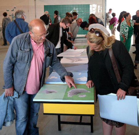
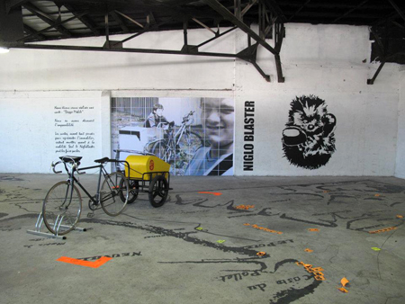
Les projets soutenus et les oeuvres
présentées dans l’édition 2012 du
festival diep ont pour point commun
de constituer des représentations
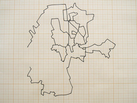
alternatives du territoire. des cartes
subjectives, exprimant un regard
singulier sur un territoire particulier,
qui ne se détache pas d’une histoire,
ou plutôt des histoires qui l’ont
structuré. des cartes qui représentent
aussi ce qui ne figure pas sur les
cartes communes : d’autres manières de pratiquer la ville, des chemins de
traverse et des zones marginales,
des portes vers l’imaginaire…
ces détournements cartographiques
invitent à re-découvrir nos espaces
et notre monde, à déplacer son
regard et ses pas, et puis aussi,
à se faire sa propre carte !
Avec : Sabine Réthoré, Arthur Eskenazi, Laurent Mareschal, Till Roeskens, Bouchra Khalili, Pauline Delwaulle, Clément Postec, Seb Coupy, David Renaud, Anne Durand, Astrid Verspieren
A Festival of Contemporary Art
Association Cybèle has as its mission the development
of art projects in the Dieppe region. It began its
work in 2005 and 2007 by organizing the Biennial Le
Temps d’une Marée (The Tide is High). Since 2010, it
has organized the Diep Festival, which every summer
hosts a exposition of diverse projects in diverse places,
with a spirit of exploration, both artistically and in
terms of the places where the works are placed. While
Diep invites some artists to present new site-specific
works, it also presents a selection of existing works,
as a way to expose people to other horizons. Diep
also hosts workshops open to the public, in particular
to children. The festival seeks above all to support
contemporary art, from production to distribution. The
festival plans its exposition each year around a specific
theme: after considering the Impressionists (2010) and
Modernism (2011), 2012 is the year of Cartography.
Cartography: a Local History
In the 16th century, during the Renaissance, Dieppe
is booming: the port has numerous trade relations
with other continents and the shipowner Jehan Ango,
governor of the city, has chartered several expeditions
of discovery to the Americas. This important maritime
activity is accompanied by the establishment in the city
of a school of cartography, which will produce globes
and portolans (nautical charts showing ports) of high
value, during a time when much of the Earth was still
unexplored. These fabulous maps, which accompanied
the great explorations of the time, are valuable both
as objects of science and as art, created as much
from the imagination of the cartographers of the time
as from their knowledge. The maps are sought both
for the knowledge they conveyed and their artistic
quality. With respect to lands that are not yet known,
these maps are characterized by great freedom of
imagination and interpretation: the Terras Incognitas
and Limitless Oceans logically gave rise to the most
exotic fantasies and most original hypotheses…
Cartography in Contemporary Art
If the old maps from Dieppe clearly show the
development of geographical knowledge, they are
also part of art history. Today, now that cartography has
established itself as a science, with its specialized tools,
vocabulary and its codes of representation; and now that
almost all of the surface of the Earth has been accurately
mapped, many artists use and abuse cartography
as a way to give another perspective to our world.
Representing both real and imaginary territories, these
maps of artists are alternatives to our official maps which
express a policy of territorial control. For the maps we use
every day, which are supposedly objective, are often the
expression or the result of strategies, whether military,
economic or urban. They are always the product of a
range of choices: scale, color, elements shown, framing…
which are never harmless. What the artists demonstrate
above all is that there are many other maps possible
to represent the same space: so many that everyone
can have his own. If there are no longer any unknown
lands, we still can rediscover the spaces we know and
find new ways to experience them and draw them.
Singular Maps
The works in the 2012 edition of the Diep festival have as
their point in common their alternative representations
of territory. They are subjective maps, expressing their
unique perspectives on particular territories, which do
not deviate from the story (or rather, stories) they have
structured. They are maps which represent what is not
on normal maps: other ways to experience the city, its
crossroads and marginal areas; they offer doors to our
imagination… These cartographic diversions invite all
to rediscover our spaces and our world, to change our
vision and our patterns, and then to make our own maps!
With: Sabine Réthoré, Arthur Eskenazi, Laurent Mareschal, Till Roeskens, Bouchra Khalili, Pauline Delwaulle, Clément Postec, Seb Coupy, David Renaud, Anne Durand, Astrid Verspieren
> Programme du Festival Diep 2012 — carto—graphies (format pdf)
